Michigan Birds Eye View Maps (1866-1889)
- Grade: 3rd - 5th
- Primary Source Set
Historical Context
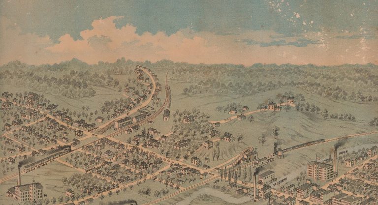
Post-Civil War communities created birds eye maps to promote their communities. A birds eye view map shows a place from an aerial or “birds eye” perspective. Artists walked the streets of a city, sketching buildings and landscaping. They also used tall buildings within the city to gain an aerial perspective. Artists would then depict the city as if viewed from above. Despite mapmakers practicing this method of mapping for centuries, birds eye view maps became immensely popular. During the Civil War, mapmakers used hot-air balloons to map enemy troop movements. After the war, artists sometimes used hot-air balloons to get the aerial perspective of a town.
Small towns and urban centers all over the United States clamored for birds eye view maps. The maps gained popularity because they offered cities, businesses, and organizations a way to promote themselves. As a result, businesses, churches, and individuals paid money to a publishing company to map their town and have their buildings included or even highlighted. These maps are often an idyllic view of a place, and try to show industry, progress, and wealth.
Learning Objectives
A familiar location is a key consideration when teaching with birds eye view maps. Making connections to a map is easier when students recognize landmarks, streets, and buildings. This primary source set of maps offers a variety of locations throughout Michigan.
Primary Source Analysis
Students can analyze the maps as primary sources. For each map, ask students to interpret:
- Point of view
- Context (when was the map made and why was it important for that location)
- Bias
- Frame of reference
For inquiry-based learning, ask students to:
- Explain how a map tell its story and/or makes its argument
- Explain the relationship between maps
- Compare and contrast maps in terms of point of view and method
- Support conclusions and interpretation with evidence
- Identify questions for further investigation
Additional Tools
- Document analysis worksheets from the National Archives
- Using primary sources from the Library of Congress
Discussion Questions
- Find a map in the set of a familiar locations for your students. Find the same area in a contemporary map (ex. Google maps, road map). Ask students to compare and contrast maps.
- Identify maps where different industries are at work. Ask students to compare and contrast maps.
Michigan Social Studies Standards
- 3-H3.0.1: Explain how historians use primary and secondary sources to answer questions about the past.
- 3-H3.0.7: Use a variety of primary and secondary sources to construct a historical narrative about daily life in the early settlements of Michigan.
- 3-G1.0.2: Use thematic maps to find and describe the physical and human characteristics of Michigan.
- 4-H3.0.5: Use visual data and informational text or primary accounts to compare a major Michigan economic activity today with that same activity or a related activity in the past.
- 4-G2.0.2: Find and describe human and physical characteristics of major U.S. regions and compare them to the Great Lakes region